Ningyōzuka:
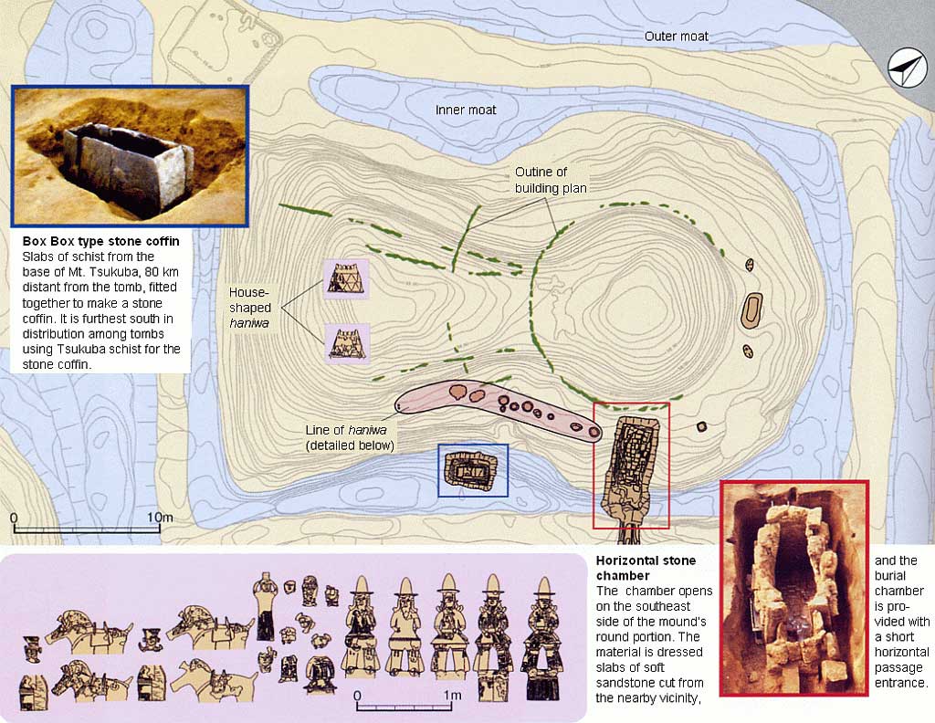
Map of the mound in its entirety
Beneath the fill used to build up the mound, an outline made with narrow ditches was discovered. These should be regarded as the building plan used in the mound’s construction; the center of the uncovered concentric rings lies at the center of the round portion of the mound, the inner circle is nearly congruent with the base of the upper tier of the mound’s round portion, and the outer circle is seen to encircle the mound’s base. The radius of the inner circle is 7.2 m, that of the outer circle is 12.6 m, and through comparison with the mound’s cross section, the inner circle is seen as marking off the area from which fill was first used in building up the round portion of the mound, and the outer circle, as detected at the tomb’s constriction, as similarly marking the area from which fill was used for the square portion of the mound.