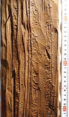
Shiotsukō: A harbor on the north coast of Lake Biwa, connecting the capital with the Japan Sea. A mokkan (wooden document) the height of a man, related to water transport, is recovered from features of a shrine.
Recovered religious paraphernalia
The items shown here were unearthed from the twelfth-century moat. In addition, there were decorative metal fittings whose shapes include one resembling a bird’s foot, a fan made of cypress wood (with the pivot intact), and an effigy in the shape of a bow.
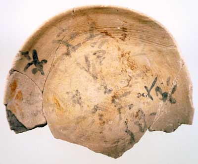
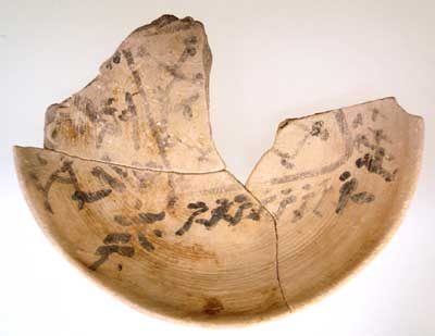
Amulets of unglazed earthenware
Twelfth century. Diameter: 9.5 cm.
The inner surfaces are filled with inscribed symbols and designs.

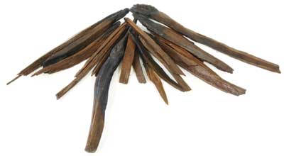
Pole for holding offerings Twelfth century. Length: 56.1 cm; width: 11 cm; thickness: 0.6 cm. The upper half has been split in forklike fashion, for holding items to be rendered as offerings to the gods. |

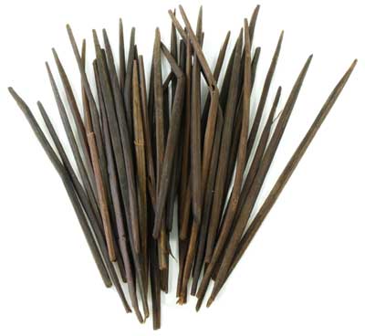
Wooden stupa Twelfth century. Length: 17 cm; diameter: 2 cm. A stupa shaped by shaving a thin round piece of wood. |
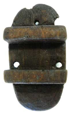
Geta Twelfth century. Length: 14.3 cm; width: 7.7 cm; thickness: 3 cm. An item of footwear of the gods. 
Phallic object Twelfth century. Length: 32 cm; diameter: 4.5 cm. |
(Bunkachō [Agency for Cultural Affairs], ed., Asahi Shimbunsha, 2008).
Photos courtesy of Shiga prefectural board of education.
Shiotsukō Site, Nishiazai Town, Shiga Prefecture
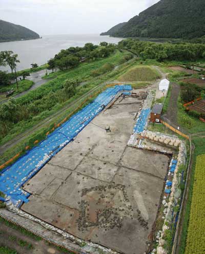
The harbor located at the northernmost edge of Lake Biwa is Shiotsukō. Crossing the Fukasaka pass to the north, there is twenty kilometers of distance to Tsuruga on the Japan Sea. The place name Shiotsukō is visible in an entry on shipping costs in the Engishiki, a Heian period compendium of procedures for implementing legal codes (put in effect in 967). The text sets the costs for the overland haul to Shiotsukō of goods, landed at Tsuruga from the six ancient provinces of the Hokuriku region (Echizen in modern Fukui prefecture, Kaga and Noto in Ishikawa, Etchū in Toyama, Echigo and Sado in Niigata), and for their transport from Shiotsukō to Ōtsu by ship. This shows Shiotsukō was among the ports boasting the greatest volume of goods in ancient Japan. The location of ancient Shiotsukō is not clear, but the port is presumed to have been near the mouth of the Ōkawa river (also called Shiotsu Ōkawa) flowing into Lake Biwa.
In 996, accompanying her father Fujiwara no Tametoki on his way to assume the post of governor of Echizen, Murasaki Shikibu arrived at Shiotsu by boat and composed a poem about a shrine on the “island of Oitsu,” thought to lie at the mouth of the Ōkawa. Even now place names linked to river deltas survive, like Ōshima (big island) and Nakashima (midstream island).
In fiscal 2006, when an excavation was conducted at the point named Ōshima in conjunction with work to repair the course of the river Ōkawa, features of a shrine from the latter half of the eleventh to the twelfth centuries were discovered.
A site comprised of three sectors
The shrine was comprised of a sanctuary sector having plentiful building remains, a vacant sector with almost no features, and outer moats.
In the sanctuary sector, the remains of the main shrine and several other buildings were found, in a manner revealing the buildings as erected in relatively congested fashion. The main shrine was rebuilt many times, changing from a structure with pillars embedded in the earth to one using pillar base stones, and the final version (twelfth century) having a stone pavement laid down as its foundation. As the different versions were rebuilt at nearly the same spot, and with the same size and orientation, they are understood as structures having the same purpose, namely, a sanctuary for worship.
From the vicinity of the buildings Haji ware (terra cotta) plates and charcoal were found in large amounts. As the charcoal is a residue left from splintering pine roots, etc., and burning them in votive lamps, it is seen that rites were frequently conducted in which lamps were burned.
A plaza extending about 20 m southward from the main shrine was a bit lower in elevation, and the 17 m from there to the moat was the featureless vacant sector. While almost no scattering of Haji ware was seen here, several cranial bones of horses, thought to have been given as offerings, were found. It is regarded as a space in which rites different from those of the sanctuary sector were conducted.
From the pottery and mokkan (wooden documents) recovered in this investigation, this site is known to have been utilized for a period of approximately 130 years from the latter half of the eleventh to the end of the twelfth centuries. The existence of eighth century features in the underlying strata also came to light.
Connection with lake transport
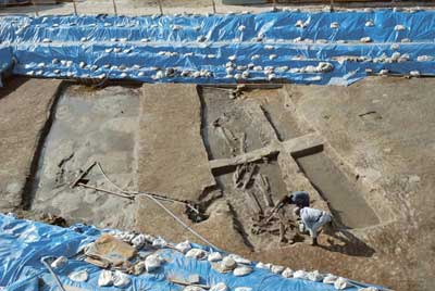
In addition, to the south of the vacant sector there were three moats (Nos. 1-3) dug in parallel fashion running east-west. All three were flat-bottomed, with sides rising straight up in boxlike fashion. Among these moat No. 1 was from the twelfth century, with a width of 4.5 m and 60 cm in depth, and was investigated over a stretch of 12 meters. Moats Nos. 2 and 3 are from the eleventh century. These moats probably formed the southern boundary of the shrine facilities.
The moats were broken at the midline of the shrine facilities, so there was probably a land bridge and road leading into the shrine at that point. At the road’s other end is Lake Biwa. Pilgrimage to the shrine was likely done by boat. Standing at the entrance to Shiotsukō, it is thought to have been a shrine closely connected with transport over the lake.
(Yokota Yōzō)