Dazaifu-related Site Group

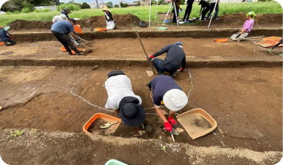
Traces of a state guesthouse found in the city grid remains. As examples of excavated guesthouses established within an ancient city are almost unknown even throughout East Asia, this is of great academic importance. Open site exhibits like this one attract great numbers of citizens every time.

kyakudens

Map of ancient Dazaifu’s city grid (courtesy of Inoue Nobumasa)
A flourishing ancient city called one of the greatest in the world, Dazaifu had the regional headquarters office located in the center of its north side, south of which a regular city grid spread out in checkerboard-like fashion. With a broad street (Suzaku Boulevard) running down its center as boundary, the city grid was referred to as the West District or East District.

Map of ancient Dazaifu’s city grid (courtesy of Inoue Nobumasa)

Adapted from Hakkutsu sareta Nihon rettō 2015 [Excavations in the Japanese Archipelago, 2015] (Bunkachō [Agency for Cultural Affairs], ed., Kyodo News, 2015).

Kokubu Matsumoto site

River remains where the mokkan was found (taken from the east)
The river remains are 13 m wide and 1.3 m deep. The cross section is in the shape of an inverted trapezoid. A mokkan (wooden document) recording changes in the population and number of households of the Shima district was found in the bottom layer of deposit lying face up.

River remains where the mokkan was found (taken from the east)

Mokkan, in situ

Mokkan, in situ

Dazaifu city grid remains

State guesthouse site
The portions outlined by the purple frames were the two embedded-pillar buildings lined north–south, thought to have been central facilities of a state guesthouse. The northern building stood 16 by 5 bays (about 260 square meters), and the southern one 11 by 5 bays (approximately 203 square meters), rivaling in area the auxiliary halls of the regional headquarters office.

State guesthouse site

Horiike site

A lowland cemetery (point cloud image from 3D coordinate measurements)
A wooden coffin burial encased in a wooden compartment and charcoal is on the northern side (front of photo). On the southern side three wooden coffin graves were detected, along with a pit burial, embedded-pillar buildings, and so forth.

A lowland cemetery (point cloud image from 3D coordinate measurements)

Miyanomoto site

Miyanomoto No. 1 burial
This was a magnificent grave, with a podium 1.5 m north–south by 2 m east–west faced with stones piled in two tiers. A land purchase record was recovered from the burial pit dug vertically in the podium’s interior.

Miyanomoto No. 1 burial

Noteworthy features and artifacts

Charcoal-encased wooden coffin burial (Horiike site)
Held to have been made in the Early Heian period (first half to mid-ninth century). About 20 examples of charcoal-encased wooden coffin burials have been reported nationwide, and they have a trend for prestigious, rare articles to be recovered as grave goods, such as mirrors, crystal beads, pearls, and lacquer boxes.

Charcoal-encased wooden coffin burial (Horiike site)

Sketch of the main facility, charcoal-encased wooden coffin burial

Adapted from Hakkutsu sareta Nihon rettō 2015 [Excavations in the Japanese Archipelago, 2015] (Bunkachō [Agency for Cultural Affairs], ed., Kyodo News, 2015).

Sketch of the main facility, charcoal-encased wooden coffin burial

Mokkan recording changes in the population and number of households of the Shima district (Kokubu Matsumoto site)

Length: 30.7 cm; width: 8 cm. This is the oldest wooden document bearing data related to household or tax registries in Japan. On the front are written household registry related terms such as “household head” ( 戸主 ) together with the names of individuals ( 建部身麻呂 Takerube no Mimaro, 伊史麻呂 Ikimaro, etc.), while characters related to taxation ( 政丁 = variant of a term for the age bracket for men 21–60 years old, which determined their tax burden) are also seen. The contents of the back likewise record individual names and terms related to changes in the numbers (such as 二戸別, indicating a household splitting in two) of households, the unit by which families were registered in ancient times.

Adapted from Hakkutsu sareta Nihon rettō 2015 [Excavations in the Japanese Archipelago, 2015] (Bunkachō [Agency for Cultural Affairs], ed., Kyodo News, 2015).

 Mokkan recording changes in the population and number of households of the Shima district (Kokubu Matsumoto site)

Dazaifu-related Site Group, Dazaifu City/Chikushino City, Fukuoka Prefecture
Asuka–Heian periods (seventh–ninth centuries)

The distant court: Dazaifu

Dazaifu is the site of the largest ancient regional government headquarters, which through enactment of the Taihō Administrative and Penal Code (701) held jurisdiction over the western provinces of Saikaidō (Kyushu), Iki, Tsushima, and Tane (the Ōsumi Islands), and also served as the gateway for foreign diplomacy. In the Man’yōshū anthology it is even poetically called the “distant court.” In the environs are ancient fortifications such as Mizuki, Ōnojō, and Kiijō, built for the defense of this region from the year following Japan’s defeat at in the Battle of Hakusukinoe (in 663, to combined forces of Tang and Silla).

The central facility of Dazaifu was the regional headquarters office where officials conducted their duties and rites, south of which spread a city laid out on a regular grid (the Dazaifu city grid remains). Within this community, divided into blocks like a checkerboard, were a variety of facilities beginning with government offices, officials’ mansions, the houses of ordinary people, and so forth. Also, many sites have been found through archaeological excavation outside the city grid as well.

The current report treats all of these as the “Dazaifu-related Site Group” and introduces a portion of their excavations.

Discovery of the oldest document related to household registers: Kokubu Matsumoto site

The site is located outside the city grid, about 1.2 km northwest of the headquarters office. A mokkan (wooden document) was recovered from the remains of a river that included artifacts from the Yayoi through the mid-Nara (mid-eighth century) periods. Thus far 13 mokkan have been found in these river remains, the largest number apart from the headquarters office district and that of the government offices to its front. Let us introduce two which have drawn attention.

The first is the oldest mokkan in Japan inscribed with household and tax registry data. This was submitted from the district of Shima to the headquarters of Chikuzen province (where Dazaifu was located), or possibly to the division in charge of Chikuzen’s affairs at Tsukushi Taisai, the agency regarded as Dazaifu’s predecessor, and in it the names, sex and social status, and family relationships of at least 16 persons can be seen. It is thought to record a change in the number of households and population of Shima district. Also, as the mokkan bears the character for district ( •] ) that was in use prior to the Taihō Code for the local unit of administration, and a title ( i‘åæÇ ) that was part of a system of 48 court ranks set up in the year Tenmu 14 (685), this item is seen to date from between the years 685–701. As the oldest surviving household registry is from the second year of the Taihō era (702), this mokkan predates it as the oldest extant household and tax registry data.

The second is a label mokkan. Its contents deal with the management of mokkan, hence it is thought to have served as an index of other documents. As it names the Shima district as part of Tsukushi no Saki no kuni, the older name for Chikuzen province, it is inferred to have been sent to the division in charge of Chikuzen’s affairs at Tsukushi Taisai. This type of mokkan being used as an index for the management of other mokkan is the first domestic example of its kind.

The ancient city of Dazaifu: Dazaifu city grid remains

Ancient Dazaifu spread out over the plain extending from the center of the modern day city of Dazaifu to its neighbor Chikushino city. There have been over 300 excavations conducted in this area over a period of more than 35 years. From the results, it has been learned that the city grid was executed on a plan based on a 90-m unit.

Recently the discovery within the Dazifu grid of artifacts and features thought to belong to a state guesthouse, where diplomatic envoys were entertained, have been in the news. At this location two very large buildings of approximately 30 and 24 meters in length (100 and 80 Japanese shaku, respectively) were found lined up north–south. Facing the western side of Suzaku Boulevard, both were high status buildings fitted with verandas. Seen among the recovered artifacts are many of the highest quality goods of the day, such as metal utensils including sahari (a copper alloy with a high tin content) tableware, Nara sancai (three-colored glazed ware), and Tang white porcelain and celadon. From these items it is thought the guesthouse was maintained from the mid-Nara into the first half of the Heian periods (mid-eighth to first half of the ninth centuries).

Dazaifu officials’ cemetery: Miyanomoto site

This is a site spreading over hills approximately 2 km from the headquarters office, centered on a cemetery of the Ancient period. Around 100 graves have been found through excavation. Graves of the Nara period in the environs of Dazaifu were thus made in the hilly areas surrounding the city.

A noteworthy artifact is a land purchase record from the Miyanomoto No. 1 burial. Such a record is a contract of sale showing that the deceased had obtained the burial plot.

Land purchase records are often recovered from tombs in China, but for Japan, other than the Miyamoto No. 1 burial item, there is only the Yatabe no Masutari land purchase record unearthed during the Edo period in Mabi-chō, in the modern city of Kurashiki, Okayama prefecture. At present, the Miyamoto No. 1 burial is being preserved at its original location as a prefecturally designated historic site, while the recovered artifacts have been designated as cultural property by the city of Dazaifu.

A grave where nobility sleeps: Horiike site

This site is located slightly south beyond the Dazaifu city grid, on the level plain on its outskirts. The age of the site is not yet determined because finds of artifacts are few, but it is thought to be from the Early Heian period (in the first half to the middle portion of the ninth century). Principal features include a state road, and a cemetery divided into sections. Of particular note is a wooden coffin burial encased in a wooden compartment and charcoal. This was a large-scale feature with a burial pit 2.6 long by 1.2 wide, around which was a circular ditch 6 m in diameter, plus an outer square ditch approximately 17 m on a side. A coffin made of Japanese cedar (1.8 m long by 0.4 m wide) was placed in the burial pit, surrounded by a larger wooden compartment making a double-layered structure, which was then encased with a large amount of packed charcoal.

Among the grave goods were items of high value such as a Yue ware celadon spittoon and lacquer ware, and from the elaborately made construction of the grave as well, it is thought to be that of an individual of high rank. The recovered spittoon is also of great value as the first example of a complete item found in Japan.

The Dazaifu region, where discoveries continue

In addition to the items introduced here, big finds have followed one after another in the Dazaifu environs in recent years. Attention will remain riveted on Dazaifu in the future as well. ( Takahashi Manabu, Kawaguchi Yōko, Ogano Akira)

Finds that convey ancient prosperity to the present

White stone belt ornaments, Dazaifu city grid remains
In front are two round-shaped items called marutomo (example on the right = 4.2 cm in width). At back is a portion of a square-shaped design called junpō, 2.7 cm in surviving width. At the time, belt ornaments were prescribed according to rank, and those of white stone could be worn only by persons of the third court rank or higher, or someone of the fourth rank who also held the post of councillor (sangi; at Daizaifu this would be an official holding a post as bureau chief).

White stone belt ornaments, Dazaifu city grid remains

Land purchase record, Miyanomoto site
Surviving length: 35.2 cm. Made of lead. The contents of the ink inscription give the circumstances of the purchase, namely that as an act of mourning for his departed father a certain man named D—Y (reading unclear) bought the land from its previous occupant (who had been buried there prior to making this grave), and specifies the price of purchase, etc.
Infrared photographic image (courtesy of Kyushu Historical Museum)

Land purchase record, Miyanomoto site

Yue ware celadon (spittoon), Horiike site
Rim diameter: 14.8 cm; body diameter: 9.7 cm; height: 9 cm. A beautiful green porcelain item fired in a kiln in Zhejiang province, China. It was recovered from within the charcoal and wooden compartment encasement of a wooden coffin burial.

Yue ware celadon (spittoon), Horiike si