Shibukawa City, Gunma Prefecture
Late Kofun period (start of the sixth century)
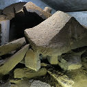
Diagonal mat fence, in situ The structured consisted of panels, made with diagonally woven mats, attached to square posts 1.8 m apart. The panels had a tripartite composition of two diagonal mats flanking a section of reed blind, fixed with four or five tiers of horizontal crosspieces, and bound together with plant stalks. As materials, the posts were Japanese chestnut, the mats used grasses and bamboos, and the binding material was grapevines.
Hypothetical reconstruction of the diagonal mat fence Adapted from Hakkutsu sareta Nihon rettō 2022 [Excavations in the Japanese Archipelago, 2022] (Bunkachō [Agency for Cultural Affairs], ed., Kyodo News, 2022).
Child wearing a necklace Roughly eight years in age, sex unknown. The child fell victim along with a young horse (sex unknown) one or two years old.
Distant view of the site (from the east) Located on a fan spreading over the northeast slope of Mt. Haruna. Pyroclastic flow struck as far as this site located 8 km distant from from Mt. Haruna’s crater. The Kanai Higashiura site, where blue plastic sheeting is visible, is about 600 m distant from Kanai Shimoshinden. Adapted from Hakkutsu sareta Nihon rettō 2022 [Excavations in the Japanese Archipelago, 2022]
Bunkachō [Agency for Cultural Affairs], ed., Kyodo News, 2022).
Plan of the entire site The southern excavation precinct had the “enclosure-shaped feature” with a group of ritual features, the northern precinct had a group of ground level structures, and there were no buildings in between. Adapted from Hakkutsu sareta Nihon rettō 2022 [Excavations in the Japanese Archipelago, 2022] (Bunkachō [Agency for Cultural Affairs], ed., Kyodo News, 2022).
A child and two horses buried by pyroclastic flow The horse at left was about two years old, sex unknown, and the horse to the right was a mare, 3–4 years old. Between them was a child of about 11 years of age. Adapted from Hakkutsu sareta Nihon rettō 2022 [Excavations in the Japanese Archipelago, 2022] (Bunkachō [Agency for Cultural Affairs], ed., Kyodo News, 2022).
Human footprints and hoof prints (from the west) The prints move from west to east. It can be seen that people were fleeing together with horses to the east before the surge of pyroclastic flow hit. These were found on top of the volcanic ash layer in the northern and southern excavation precincts.
Artifacts from within the “enclosure-shaped feature”
Small domestic mirror and stone imitative articles, in situ These were found just inside the posts of the diagonal mat fence, while two sword-shaped stone imitative articles were buried immediately below. As an embedded-pillar building and a circular podium-shaped rise were nearby, this is thought to have been a ritual area.
Sword-shaped stone imitative articles Recovered from beneath the small domestic mirror. Length: Item at left, 6.3 cm; item at right, 5.6 cm.
Small domestic mirror Inferred as having been buried to placate the gods of the earth for the construction of the “enclosure-shaped feature.” Diameter: 6.2 cm.
(Captions, p. 49)
Ritual feature A Starting with a compound magatama (a large comma-shaped bead with miniatures attached), Haji ware, Sue ware, iron implements, mortar-shaped beads, and so forth were recovered from within an unroofed embedded-pillar building. A portion of the upper extremity of the compound magatama was broken off, and that fragment was also found.
Ritual feature B A large quantity of pottery was recovered, beginning with large-scale jar stands in the form of pedestalled dishes. The Sue ware pedestalled dish-shaped jar stands ( ) were found with their dish and pedestal portions separate from each other. It is possible that the the dish portions were removed as the final stage of the ritual.
Iron arrowheads (two items at left) and an iron axe From the large size and manner of fashioning that differed from items for practical use, these are inferred to have been ritual items. Length, from the left: 14.3 cm, 17.5 cm, 15 cm.
Stone imitative articles Adapted from Hakkutsu sareta Nihon rettō 2022 [Excavations in the Japanese Archipelago, 2022] (Bunkachō [Agency for Cultural Affairs], ed., Kyodo News, 2022).
Ritual feature C Handbuilt pottery, Haji ware, iron implements, stone imitative articles, mortar-shaped beads, and so forth were found together.
A Kofun period space comes back to life: A village devastated by a volcanic eruption
A regional chief’s headquarters enclosed by a diagonal mat fence
Kanai Shimoshinden is a site abutting the southern side of the Kanai Higashiura site where a “Kofun period man dressed in armor” was discovered and gained widespread attention. Located at the tip of a fan formed by deposits of flows of pyroclastic debris and mud from volcanic eruptions, it is sealed off on its eastern side by a terrace cliff of about 20 m in height. Excavation in conjunction with the construction of a national road bypass was conducted from 2014 to 2017, and a village was discovered buried under the same volcanic ash from the start of the sixth century as the Kanai Higashiura site.
The settlement just prior to the eruption was divided into three areas based on the presence and types of buildings. The first was in the northern portion of the northern excavation precinct, where a section marked off by a fence was detected, within which lay some garden land and small-scale ritual features, plus a group of ground-level structures (i.e., not built with floors dug below the surface). The second area extended from the site’s center to the northern excavation precinct, where a small-scale accumulation of pottery and a group of pit-structures that had been abandoned prior to the eruption and were in the process of filling in were detected. The third was in the southern excavation precinct, where an “enclosure-shaped feature” with a group of ritual features in its environs was detected. Among these finds, the enclosure-shaped feature in the southern excavation precinct is particularly noteworthy. Most of the headquarter-like facilities of powerful figures of the Kofun period discovered thus far are marked off by a rectangular moat or fence on the perimeter, with buildings laid out in planned fashion on the inside; the enclosure-shaped feature surrounded by a diagonally patterned mat fence certainly meets these specifications, and is thought to be the headquarters of a regional chief.
A blacksmith’s workshop, and children and horses struck by disaster
In the northern excavation precinct, within the sectioned marked off by a fence there were six ground-level structures detected. Based on whether or not the volcanic ash was deposited directly on top of the floor within the structure, the presence or absence of a roof at the time of the eruption can be discerned, and it was seen that four of the six buildings had roofs. Meanwhile, a smith’s forge was found in one building lacking a roof and thought to have already been torn down, making clear the existence of a blacksmith’s workshop as a ground-level structure.
Outside the fence, two children aged about eight and eleven years, along with two ponies and a mare, were found buried under the pyroclastic flow within the depressions of partially filled in pit-structures that had been abandoned prior to the eruption. The presence of ponies and a mare indicates the possibility that horse breeding was being carried out at this site. Also, as all of the horses were recovered together with the children, it is possible as well that children had a hand in the raising of horses. The child aged approximately eight years was wearing a necklace made with a magatama (comma-shaped bead) and cylindrical beads.
Ritual features dotted within and around the base facility
The enclosure-shaped feature of the southern excavation precinct was an area in the shape of a parallelogram approximately 54 m on a side, inferred to have been surrounded with a fence of diagonally woven matting 3 m in height. The diagonal mat fence had collapsed on top of the volcanic ash and was carbonized, and is understood to have been standing at the time of the eruption and toppled by the pyroclastic flow. The interior of the enclosure-shaped feature was divided into eastern and western halves by a fence. In the western portion was a single embedded-pillar building and a circular rise in the shape of an earthen podium, and in the portion’s southwestern and southeastern corners were found a small domestic mirror and shield-shaped stone imitative articles. In the eastern portion, in addition to a large-scale pit-structure 9 m on a side, another pit-structure, an embedded-pillar building, and some cultivated plots were discovered. Volcanic ash was deposited directly on the floors of these buildings, and traces were preserved within the pyroclastic flow of architectural members such as roof beams and pillars that appear to have been pulled up from their original positions. From this it is believed that at the time of the eruption these structures had already lost their roofs and their dismantling had begun.
Ritual features were found outside the enclosure at one location to the north, and at six locations on the south side. All of these are thought to have been related to the enclosure-shaped feature, with pottery for ritual use, iron implements, and stone imitations of swords and tools for carpentry and farming, etc., being found in groups, while the numbers and types of pottery and stone imitative articles, the presence or absence of iron implements, and the conditions in which these items were accumulated and so forth differing for each feature. From one of the embedded-pillar buildings on the south side of the enclosure, a compound magatama (a large comma-shaped bead with miniatures attached) was recovered. Along with the compound magatama, there were numerous small mortar-shaped beads on the ground surface within the structure, immediately above which volcanic ash had accumulated, and within the pyroclastic flow were traces of pillars, from which the structure is thought to have lacked a roof and was used for conducting rituals with only the pillars standing.
The area in the vicinity of the northeast slope of Mt. Haruna is exceptionally rare nationwide as a region where the concrete form can be known of Kofun period villages, which were buried by volcanic material from two eruptions in the sixth century. From beneath the volcanic ash from the start of the sixth century, in addition to the Kanai Higashiura site the Nakasuji site has been discovered, and on the southern slope of Mt. Komochi where large amounts of pumice fell from an eruption in the mid-sixth century, the National Historic Site of Kuroimine and the Shiroi site group have been investigated. Buried under volcanic material, the shape of the daily lives of people of the Kofun period has been preserved at these sites in a way that never survives at other sites, for which they are important sites for knowing the actual conditions of the Kofun period.
At the investigation of the Kanai Shimoshinden site, the detailed structure of the headquarters of a regional chief, and concrete images of the rituals conducted in the vicinity have become clear. Only a very small portion of the site was excavated, with the space surrounding a regional chief of the Kofun period lying still buried underneath the volcanic ash. (Kojima Atsuko)